Category:East Huntspill
Jump to navigation
Jump to search
village and civil parish in Somerset, England, UK  | |||||
| Upload media | |||||
| Instance of | |||||
|---|---|---|---|---|---|
| Location | Sedgemoor, Somerset, South West England, England | ||||
 | |||||
Subcategories
This category has only the following subcategory.
B
- Bason Bridge railway station (3 F)
Media in category "East Huntspill"
The following 169 files are in this category, out of 169 total.
-

-

-
 All Saints Church, East Huntspill - geograph.org.uk - 1822002.jpg 1,600 × 1,200; 793 KB
-
 B3141 approaching Cote - geograph.org.uk - 4870698.jpg 1,920 × 1,176; 846 KB
-
 B3141 at Quaking Bridge - geograph.org.uk - 4870567.jpg 1,918 × 1,239; 688 KB
-
 B3141 in East Huntspill - geograph.org.uk - 4871265.jpg 3,055 × 1,939; 1.72 MB
-
 B3141 near Watchfield - geograph.org.uk - 4871388.jpg 1,920 × 1,280; 746 KB
-
 Barn, Sunrise Farm - geograph.org.uk - 4986740.jpg 640 × 329; 39 KB
-
 Bason Bridge - geograph.org.uk - 4871274.jpg 1,920 × 1,280; 587 KB
-
 Bason Bridge, post office - geograph.org.uk - 852706.jpg 640 × 437; 49 KB
-
 Basonbridge Inn - geograph.org.uk - 1822072.jpg 1,600 × 1,157; 337 KB
-
 Bay Tree Farm, Watchfield - geograph.org.uk - 1822079.jpg 1,600 × 1,200; 454 KB
-
 Black Ditch, Puriton Level - geograph.org.uk - 3902870.jpg 1,024 × 768; 208 KB
-
 Burtle Road - geograph.org.uk - 4964888.jpg 1,920 × 1,280; 888 KB
-
 Burtle Road - geograph.org.uk - 4964903.jpg 1,920 × 1,186; 820 KB
-
 Burtle Road - geograph.org.uk - 5067098.jpg 1,024 × 768; 188 KB
-
 Chilton Moor - geograph.org.uk - 4965308.jpg 3,072 × 2,048; 1.33 MB
-
 Chilton Moor - geograph.org.uk - 4965428.jpg 1,920 × 1,280; 969 KB
-
 Church Road (B3141), East Huntspill - geograph.org.uk - 4871259.jpg 1,920 × 1,214; 696 KB
-
 Church Road (B3141), East Huntspill - geograph.org.uk - 4871285.jpg 1,920 × 1,280; 496 KB
-
 Comfiest bed on the levels - geograph.org.uk - 4873648.jpg 1,399 × 1,010; 538 KB
-
 Corrugated shed - geograph.org.uk - 5229093.jpg 640 × 330; 50 KB
-
 Corrugated sheds - geograph.org.uk - 4986767.jpg 640 × 426; 61 KB
-
 Cotelea on Cote Corner - geograph.org.uk - 5067102.jpg 1,024 × 831; 198 KB
-
 Court Farm - geograph.org.uk - 5067115.jpg 1,024 × 768; 206 KB
-
 Cripp's Bridge - geograph.org.uk - 5081427.jpg 1,024 × 768; 320 KB
-
 Cripps Farm Holiday Park - geograph.org.uk - 5081437.jpg 1,024 × 768; 142 KB
-
 Cripps River - geograph.org.uk - 4964690.jpg 3,064 × 1,793; 1.35 MB
-
 Cripps River - geograph.org.uk - 5066851.jpg 1,024 × 768; 254 KB
-
 Cripps River at Gold Corner - geograph.org.uk - 4965102.jpg 3,061 × 1,892; 1.08 MB
-
 Cripps River at Gold Corner - geograph.org.uk - 4965135.jpg 3,072 × 1,727; 973 KB
-
 Crossing the Huntspill river - geograph.org.uk - 4738824.jpg 640 × 383; 38 KB
-

-
 Drove junction, Chilton Moor - geograph.org.uk - 4965271.jpg 1,920 × 1,280; 975 KB
-
 Church at East Huntspill - geograph.org.uk - 109473.jpg 640 × 426; 140 KB
-
 East Huntspill , M5 Motorway - geograph.org.uk - 6283759.jpg 6,000 × 4,000; 4.55 MB
-
 East Huntspill.jpg 640 × 426; 128 KB
-
 Eastern Moor Bridge - geograph.org.uk - 4964624.jpg 3,068 × 1,911; 1.34 MB
-
 Eastern Moor Bridge - geograph.org.uk - 5066862.jpg 1,024 × 768; 207 KB
-
 Entrance drive, Withy Road Farmhouse - geograph.org.uk - 3904006.jpg 1,024 × 766; 197 KB
-
 Farm buildings, Huntspill Moor - geograph.org.uk - 4871231.jpg 1,920 × 1,395; 1.03 MB
-
 Farm road bridge over M5 - geograph.org.uk - 2496968.jpg 800 × 600; 312 KB
-
 Farmland in Brue Valley - geograph.org.uk - 5991902.jpg 1,024 × 681; 88 KB
-
 Field and farm near Bason Bridge - geograph.org.uk - 4871294.jpg 1,920 × 1,280; 713 KB
-
 Field by Merry Lane - geograph.org.uk - 4871312.jpg 1,920 × 1,280; 1.07 MB
-
 Field by the Huntspill River - geograph.org.uk - 4964940.jpg 3,059 × 1,739; 1.35 MB
-
 Field on Huntspill Moor - geograph.org.uk - 4862314.jpg 3,029 × 1,741; 1.26 MB
-
 Former level crossing on Highbridge branch - geograph.org.uk - 5066792.jpg 1,024 × 768; 193 KB
-

-
 Gold Corner Drove - geograph.org.uk - 4862769.jpg 1,920 × 1,152; 827 KB
-
 Gold Corner Drove - geograph.org.uk - 4862796.jpg 1,920 × 1,280; 1.15 MB
-
 Gold Corner Drove - geograph.org.uk - 4965393.jpg 1,920 × 1,280; 1,006 KB
-
 Gold Corner Drove - geograph.org.uk - 5250889.jpg 1,024 × 768; 229 KB
-
 Gold Corner Drove - geograph.org.uk - 5250896.jpg 1,024 × 768; 239 KB
-
 Gold Corner Sluice, Cripps River - geograph.org.uk - 4965049.jpg 3,056 × 1,793; 1.12 MB
-
 Grazing sheep on Huntspill Moor - geograph.org.uk - 5067095.jpg 1,024 × 817; 204 KB
-
 Hackness Sluice on the River Brue - geograph.org.uk - 4550755.jpg 1,024 × 768; 191 KB
-
 Heath House Farm - geograph.org.uk - 4862454.jpg 1,920 × 1,280; 799 KB
-
 Hedge - geograph.org.uk - 5545782.jpg 640 × 426; 62 KB
-
 Hedgerow - geograph.org.uk - 4986757.jpg 640 × 426; 50 KB
-
 House on Withy Grove - geograph.org.uk - 4549651.jpg 1,024 × 768; 120 KB
-
 House on Withy Road - geograph.org.uk - 3903994.jpg 1,024 × 768; 181 KB
-
 Huntspill Level - geograph.org.uk - 4947720.jpg 1,518 × 700; 141 KB
-
 Huntspill Level - geograph.org.uk - 4947808.jpg 2,759 × 997; 367 KB
-
 Huntspill Level - geograph.org.uk - 4986753.jpg 640 × 426; 44 KB
-
 Huntspill Level - geograph.org.uk - 5229090.jpg 640 × 281; 30 KB
-
 Huntspill Level - geograph.org.uk - 5229091.jpg 640 × 369; 35 KB
-
 Huntspill Level - geograph.org.uk - 5229092.jpg 640 × 245; 28 KB
-
 Huntspill River - geograph.org.uk - 4870608.jpg 1,920 × 1,136; 308 KB
-
 Huntspill River - geograph.org.uk - 4947742.jpg 3,072 × 1,744; 660 KB
-
 Huntspill River - geograph.org.uk - 4986728.jpg 640 × 426; 29 KB
-
 Huntspill River - geograph.org.uk - 4986730.jpg 640 × 460; 52 KB
-
 Huntspill River - geograph.org.uk - 5229087.jpg 640 × 373; 41 KB
-
 Huntspill River - geograph.org.uk - 5545779.jpg 640 × 426; 54 KB
-
 Huntspill River - geograph.org.uk - 5804495.jpg 5,472 × 3,648; 7.23 MB
-
 Huntspill River - geograph.org.uk - 5991896.jpg 1,024 × 681; 92 KB
-
 Huntspill River crossing, Southbound M5 - geograph.org.uk - 3801827.jpg 640 × 480; 240 KB
-
 Huntspill river from M5 motorway - geograph.org.uk - 1875210.jpg 640 × 485; 49 KB
-

-
 Huntspill River, late afternoon - geograph.org.uk - 2158717.jpg 640 × 480; 135 KB
-
 Huntspill River, late afternoon - geograph.org.uk - 2158720.jpg 640 × 480; 188 KB
-
 Jeffries Farm, Hackness - geograph.org.uk - 4550781.jpg 1,024 × 768; 155 KB
-
 Lambs on Longmoor Drove - geograph.org.uk - 4387506.jpg 640 × 480; 70 KB
-
 Lane on the Somerset Levels - geograph.org.uk - 2990094.jpg 640 × 480; 129 KB
-
 Lonely Pillar - geograph.org.uk - 2679681.jpg 3,648 × 2,736; 3.65 MB
-
 Long Moor Drove - geograph.org.uk - 4964676.jpg 3,072 × 2,048; 1.66 MB
-
 Long Moor Drove at Eastern Moor Bridge - geograph.org.uk - 4873129.jpg 1,920 × 1,336; 613 KB
-
 Long Moor Drove at Red House - geograph.org.uk - 4964784.jpg 1,024 × 1,536; 629 KB
-
 Looking northeast along the B3141 - geograph.org.uk - 4927762.jpg 1,600 × 1,200; 502 KB
-
 Looking west-northwest along the Huntspill River - geograph.org.uk - 4928907.jpg 3,264 × 2,448; 1.83 MB
-
 M5 bridge over Huntspill River - geograph.org.uk - 5229086.jpg 640 × 270; 28 KB
-
 M5 crossing Huntspill Level - geograph.org.uk - 4738811.jpg 640 × 412; 38 KB
-
 M5 crossing Huntspill River - geograph.org.uk - 2668200.jpg 800 × 601; 327 KB
-
 M5 crossing the River Brue - geograph.org.uk - 3626322.jpg 1,677 × 1,036; 922 KB
-
 M5 Motorway - Hunstspill River Sign. - geograph.org.uk - 2623488.jpg 640 × 475; 45 KB
-
 M5 Motorway - River Brue Sign - geograph.org.uk - 2625082.jpg 640 × 475; 47 KB
-
 M5 overbridge carries Newbridge Lane - geograph.org.uk - 3181863.jpg 3,391 × 2,517; 1.53 MB
-
 M5 overbridge carries Withy Road - geograph.org.uk - 3181874.jpg 3,422 × 2,458; 1.33 MB
-
 M5 southbound approaching Huntspill River crossing - geograph.org.uk - 3654886.jpg 1,600 × 1,000; 278 KB
-
 M5 southbound, New Road bridge - geograph.org.uk - 3654864.jpg 1,891 × 1,158; 1.09 MB
-
 Merry Farm - geograph.org.uk - 5081442.jpg 1,024 × 877; 209 KB
-
 Merry Lane - geograph.org.uk - 4862339.jpg 1,920 × 1,190; 578 KB
-
 Mill Farm - geograph.org.uk - 4986769.jpg 640 × 426; 57 KB
-
 Mill Farm - geograph.org.uk - 5545783.jpg 640 × 426; 66 KB
-
 Mill Lane, East Huntspill - geograph.org.uk - 1506864.jpg 640 × 470; 128 KB
-
 New Road bridge from M5 northbound - geograph.org.uk - 4738833.jpg 640 × 393; 51 KB
-
 New Road bridge over M5 - geograph.org.uk - 2496977.jpg 800 × 600; 309 KB
-

-
 Newbridge Lane overbridge - geograph.org.uk - 4738840.jpg 640 × 425; 56 KB
-

-

-

-
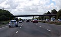
 On the M5 - geograph.org.uk - 4144137.jpg 4,000 × 2,664; 1.88 MB
-
 On the M5 - geograph.org.uk - 4144147.jpg 4,000 × 2,664; 3.95 MB
-
 One mile from junction 23 M5 south - geograph.org.uk - 4032882.jpg 640 × 257; 36 KB
-
 Outbuildings, at Sunrise Farm - geograph.org.uk - 3904621.jpg 1,024 × 787; 220 KB
-
 Pasture land - geograph.org.uk - 4986748.jpg 640 × 337; 40 KB
-
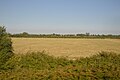 Pasture land - geograph.org.uk - 5991897.jpg 1,024 × 681; 116 KB
-
 Pasture, Mill Farm - geograph.org.uk - 5545786.jpg 640 × 426; 70 KB
-
 Power Lines cross Merry Lane - geograph.org.uk - 5081575.jpg 1,024 × 848; 170 KB
-
 Rhyne meeting Huntspill River - geograph.org.uk - 4964917.jpg 1,920 × 1,280; 910 KB
-
 Rhyne, Chilton Moor - geograph.org.uk - 4965563.jpg 1,920 × 1,110; 692 KB
-
 Rhyne, Gold Corner Drove - geograph.org.uk - 4964955.jpg 1,920 × 2,686; 1.47 MB
-
 Rivenhall Cottage - geograph.org.uk - 3904015.jpg 1,024 × 768; 151 KB
-
 River Brue at Bason Bridge - geograph.org.uk - 4871279.jpg 1,920 × 2,880; 1.55 MB
-
 River Brue from M5 near Highbridge - geograph.org.uk - 1875215.jpg 640 × 495; 63 KB
-
 River Brue, Bason Bridge - geograph.org.uk - 1822055.jpg 1,600 × 1,200; 625 KB
-
 Road junction on the Somerset Levels - geograph.org.uk - 2065518.jpg 640 × 480; 117 KB
-

-
 Rough grassland - geograph.org.uk - 5229088.jpg 640 × 426; 68 KB
-

-
-
 Rutted field, Huntspill Moor - geograph.org.uk - 4862751.jpg 1,920 × 1,095; 809 KB
-
 Sedgemoor , M5 Motorway - geograph.org.uk - 5946846.jpg 6,000 × 4,000; 6.84 MB
-
 Sedgemoor , M5 Motorway - geograph.org.uk - 5946847.jpg 6,000 × 4,000; 6.73 MB
-
 Sedgemoor , New Road - geograph.org.uk - 2293528.jpg 4,288 × 2,848; 6.77 MB
-
 Sedgemoor , Secret World Badger ^ Wildlife Rescue Centre - geograph.org.uk - 2293534.jpg 4,288 × 2,848; 6.97 MB
-
 Sedgemoor District , The M5 Motorway - geograph.org.uk - 4930095.jpg 6,000 × 4,000; 5.69 MB
-
 Shaking Drove - geograph.org.uk - 4965252.jpg 3,072 × 2,048; 1.56 MB
-
 Shaking Drove - geograph.org.uk - 4965297.jpg 1,920 × 1,280; 909 KB
-
 Shaking Drove - geograph.org.uk - 4965314.jpg 2,923 × 1,483; 1.48 MB
-
 Shaking Drove - geograph.org.uk - 5250891.jpg 1,024 × 780; 224 KB
-
 Sheep between railway and motorway - geograph.org.uk - 4986744.jpg 640 × 426; 48 KB
-
 Sheep grazing - geograph.org.uk - 5545787.jpg 640 × 426; 68 KB
-
 Sheep grazing on the river bank - geograph.org.uk - 5066874.jpg 1,024 × 768; 236 KB
-
 Sheep, Huntspill Moor - geograph.org.uk - 4964854.jpg 3,029 × 1,930; 1.42 MB
-
 Signpost, Red House - geograph.org.uk - 4964820.jpg 1,911 × 1,576; 746 KB
-
 Sluice on Cripps River - geograph.org.uk - 5250874.jpg 1,024 × 768; 178 KB
-
 Southbound M5, Huntspill Level - geograph.org.uk - 3801831.jpg 640 × 480; 237 KB
-
 Southbound M5, New Road Bridge - geograph.org.uk - 3801818.jpg 640 × 480; 239 KB
-
 Southbound M5, Newbridge Lane Bridge - geograph.org.uk - 3801814.jpg 640 × 480; 218 KB
-
 Straight Drove - geograph.org.uk - 5066913.jpg 1,024 × 768; 267 KB
-
 Sunningdale, Cote Corner - geograph.org.uk - 5067107.jpg 1,024 × 768; 158 KB
-
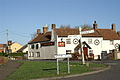
 The Crown, East Huntspill (geograph 1821958).jpg 1,600 × 1,200; 370 KB
-
 The Crown, East Huntspill - geograph.org.uk - 1506865.jpg 640 × 480; 68 KB
-
 The M5 about to cross the Huntspill River - geograph.org.uk - 5506627.jpg 5,370 × 3,123; 4.29 MB
-
 The M5 Motorway, looking north - geograph.org.uk - 4549641.jpg 1,024 × 763; 161 KB
-
 The M5 Motorway, looking north - geograph.org.uk - 4549729.jpg 1,024 × 789; 157 KB
-
 The River Brue - geograph.org.uk - 4550770.jpg 1,024 × 742; 123 KB
-
 The River Brue, Highbridge - geograph.org.uk - 6334390.jpg 600 × 800; 215 KB
-
 Track on Little Moor - geograph.org.uk - 5066882.jpg 1,024 × 768; 220 KB
-
 Trackbed of former Highbridge branch - geograph.org.uk - 5066810.jpg 1,024 × 768; 238 KB
-
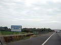
 Turning for East Huntspill - geograph.org.uk - 5066905.jpg 1,024 × 820; 220 KB
-
 Upstream along the Brue, Highbridge - geograph.org.uk - 4520781.jpg 800 × 648; 133 KB
-
 Valve, Woolavington Bridge - geograph.org.uk - 4870605.jpg 2,048 × 3,072; 989 KB
-
 Withy Pill Rhyne - geograph.org.uk - 4862304.jpg 1,920 × 1,193; 846 KB
-
 Withy Road bridge over M5 - geograph.org.uk - 2496990.jpg 800 × 600; 306 KB
-
 Withy Road Farm - geograph.org.uk - 4549665.jpg 1,024 × 870; 151 KB
-
 Woolavington Bridge - geograph.org.uk - 4870601.jpg 3,072 × 2,048; 856 KB


,_East_Huntspill_-_geograph.org.uk_-_4871259.jpg)
,_East_Huntspill_-_geograph.org.uk_-_4871285.jpg)


.jpg)


